By Jennifer Hiller and Devika Krishna Kumar
HOUSTON/MOBILE, Ala. (Reuters) - For Grant Saltz, who runs a barbecue restaurant in Mobile, Alabama, what struck him about Hurricane Sally was its steady, deliberate pace, after the storm rumbled into the U.S. Gulf Coast on Wednesday as a powerful Category 2 hurricane.
"It’s so slow, this one," said Saltz, 38, while clearing away tree branches during a pause in the rains. "We had strong winds for a long period of time. Instead of a few hours we got it for 12 hours."
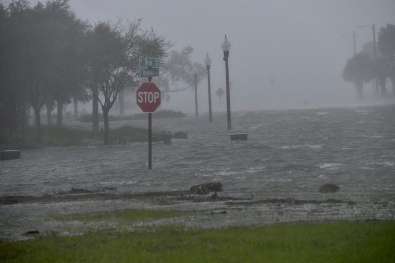
Sally is not the most powerful storm to batter the U.S. Gulf Coast in recent memory, but its glacial pace is becoming a regular feature of the deadly storms, which some scientists attribute to climate change. The storm has already dropped more than 18 inches of rain in the last 24 hours, with more rainfall looming, the National Hurricane Center said.
At one point during its approach, Sally was moving at a mere 2 miles per hour (3.2 kph), recalling Hurricanes Harvey in Houston in 2017, Florence in the Carolinas in 2018, and Dorian in the Bahamas in 2019, massive weather systems that parked over land and dumped rain that had to be measured in feet instead of inches.
A 2018 study found that tropical cyclone speed has decreased globally by 10% since 1949 as the atmosphere warms, which creates the chance for drenching rain to inundate the coastline, said Jennifer Collins, professor in the school of geosciences at the University of South Florida.
"These North Atlantic hurricanes are increasingly likely to stall near the coast for many hours," Collins said.
The question of whether climate change is causing some storms to slow down before landfall is the topic of "a lot of papers flying back and forth and discussions and arguments" among meteorologists, said Phil Klotzbach, atmospheric scientist at Colorado State University.
"The thing that’s more well agreed upon is that the warmer atmosphere is going to bring more rain," Klotzbach said. That is what worries scientists given how busy 2020's hurricane season has been. The Atlantic basin has seen eight hurricanes already, a milestone reached at this point just three times in the past - in 1893, 2005 and 2012, Klotzbach said.
There have been 20 named storms this season in the Atlantic basin and the National Hurricane Center is monitoring four now - Sally, Paulette, Teddy and Vicki, with another system in the southwestern Gulf of Mexico possibly becoming a depression in the next several days.
"What is changing is water temperatures are warmer and there are more storms," said Jim Foerster, chief meteorologist at DTN, an energy, agriculture and weather data provider.
The popular focus on the Saffir-Simpson Hurricane Wind Scale, which ranks hurricanes on a 1 to 5 rating based on sustained wind speed, "doesn't take into account the storm surge and the rainfall flooding," Collins said, which is usually more deadly than high winds.
Hurricane Harvey overwhelmed the city of Houston with rain for several days, with some areas seeing about five feet in precipitation. It turned highways into tidal rivers as the wettest ever tropical cyclone to hit the United States.